(Available in Pro Platinum and Expert)
Default UI Menu: Tools/Palettes/TurboCAD Coordinates Export Palette
Ribbon UI Menu:
This palette tool provides the ability to export the point data from your drawing.
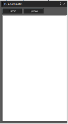
TC Coordinates Options
Before exporting your point data it is best practice to configure the data output. Click the Options button to open the Options dialogue. Once open you can specify what data to export and the format of the data.
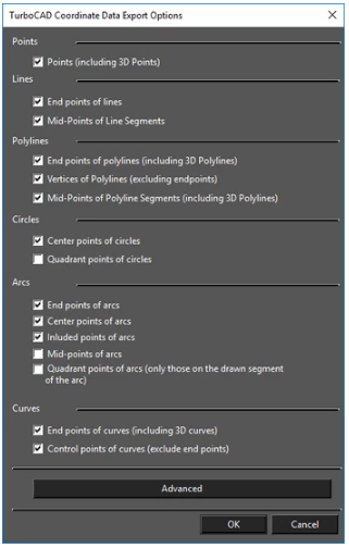 The basic options allow you to set which types of points you wish used in the export. These include: Points:
- Points (including 3D Points)
Lines:
- End points of lines
- MidPoints of Line Segments
Polylines:
- End points of polylines (including 3D Polylines)
- Vertices of Polylines (excluding endpoints)
- Midpoints of Polyline Segments (including 3D Polylines)
Circles:
- Center points of circles
- Quadrant points of circles
Arcs:
- End points of arcs
- Center points of arcs
- Included points of arcs
- Midpoints of arcs
- Quadrant points of arcs (only those on the drawn segment of the arc)
Curves:
- End points of curves (including 3D curves)
- Control points of curves (exclude end points)
TC Coordinates Advanced Options
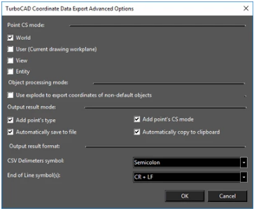 Clicking the Advanced button in the TC Coordinates Options dialogue opens the Advanced Options dialogue which allows you to configure how points are to be analyzed and how they are to be exported. These options include:
Point CS mode: specifies what coordinate system will be used to determine the point location. There are four options, World is the defgault.
Clicking the Advanced button in the TC Coordinates Options dialogue opens the Advanced Options dialogue which allows you to configure how points are to be analyzed and how they are to be exported. These options include:
Point CS mode: specifies what coordinate system will be used to determine the point location. There are four options, World is the defgault.
- World
- User (Current drawing workplane)
- View
- Entity
Object processing mode:
- Use explode to export coordinate of non-default objects: specifies whether blocks, groups and other compound object should be exploded (internally) to compute the point data within them.
Output result mode:
- Add point's type: Appends the points object type to the location data
- Add point's CS mode: Appends the points Coordinate System info to the location data.
- Automatically save to file: Prompts to save the data to file every time you click the Export button.
- Automatically copy to clipboard: Automatically adds the data to the system clipboard when you click the Export button.
Output result format:
CSV Delimiters symbol: Specifies the data divider (delimiter) to be used in output. There are three options.
- Semicolon
- Tab
- Comma
End of Line symbol(s): Specifies the symbol that will be used to designate the end of line in the data file. There are three options.
- CR + LF
- CR (Carriage Return)
- LF (Line Feed)
Using TC Coordinates
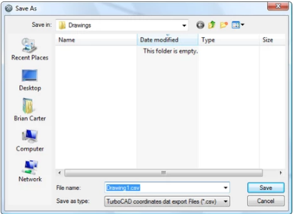
To use TC Coordinates simply click the Export button. The data area of the TC Coordinates palette will be filled with the relevant data. Depending upon the settings in Advanced options, the system clipboard will be filled with the data and/or the Save As dialog will open so that you can save the file.
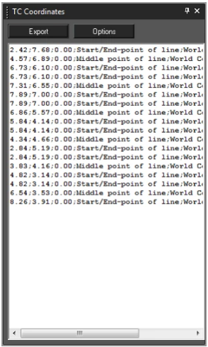
Note: It is important to delete the contents of the data area of the TC Coordinates palette after each use, or before subsequent use. The palette will not automatically delete data and will simply add new data to previous data each time you click the Export button.
To delete the content of the TC Coordinate Palette:
- Click in the palette.
- Press CTRL+A keys to select everything in the palette.
- Press the Delete key.